World Map of Fascinating Facts – Mountains, Rivers, Flags & Geography
Tax included.
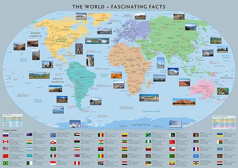
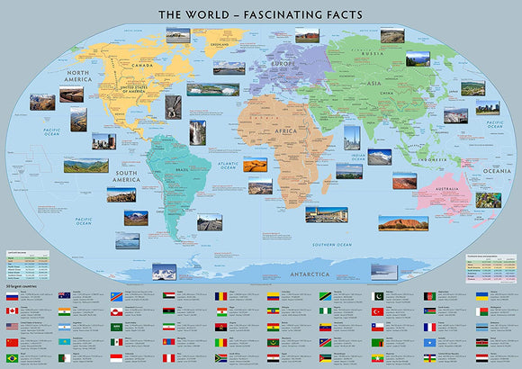
Discover fascinating facts from around the globe with this colourful and informative World Map of Fascinating Facts. Packed with geographical information, national flags and interesting facts, it provides an engaging way for children and adults to explore the world.
Ideal for home schooling, fun quizzes, classroom displays and home learning projects, the map can also be used as a colourful wall poster and written on with dry-wipe markers for interactive learning activities.
Product Features
- World Map of Fascinating Facts – Packed with interesting geographical information from around the globe.
- Highest Mountains – Features information about some of the world's highest mountains.
- Longest Rivers – Discover some of the longest rivers around the world.
- Flags of the Nations – Includes flags representing countries around the world.
- Interactive Learning – Can be written on with dry-wipe markers for quizzes and activities.
- Home Schooling Resource – Ideal for geography lessons and home education.
- Fun Quizzes – Perfect for creating geography quizzes and testing world knowledge.
- Colourful Wall Display – Makes an engaging and informative educational poster.
- Versatile Geography Resource – Suitable for classrooms, home learning and educational displays.
Product Details
- Size: 100 x 70 cm
- Subject: Geography & World Studies
- Features: World map, fascinating facts, highest mountains, longest rivers and national flags
- Format: Laminated paper
- Suitable For: Home schooling, geography lessons, quizzes, classroom displays and home learning
Material & Finish
Printed onto high-quality paper and finished with a durable laminate. The laminated surface can be written on with dry-wipe markers, making the map suitable for interactive learning, quizzes and repeated use.