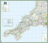
Cornwall County Map
Tax included.
1:100,000 detailed map of Cornwall, a county in England, UK.
This map covers the city of Truro and:
- Land's End
- Lizard Point
- Bude
- Boscastle
- Saltash
- Newquay
- St Austell
- Penzance
- St Ives
and the districts:
- Cornwall
- Isles of Scilly
116 x 128 cm paper map
The map features the county boundary, roads, railways, land features, water features and tourist information.


