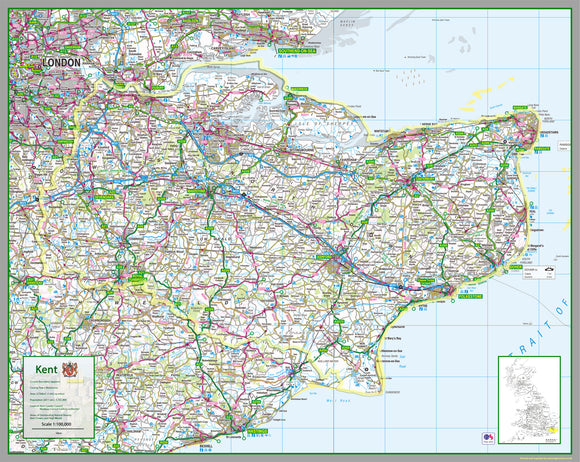


Kent County Map
Tax included.
1:100,000 detailed map of Kent, a county in the South of England, UK.
This map covers the City of Rochester and towns
- Maidstone
- Gillingham
- Dartford
- Chatham
- Ashford
- Rochester
- Margate
- Royal Tunbridge Wells
- Gravesend
- Canterbury
- Folkestone
- Sittingbourne
- Dover
- Ramsgate
- Tonbridge
and the Districts of:
- Ashford
- Canterbury
- Dartford
- Dover
- Folkestone and Hythe
- Gravesham
- Maidstone
- Sevenoaks
- Swale
- Thanet
- Tonbridge and Malling
- Tunbridge Wells
90 x 113 cm paper laminated map
The map features the county boundary, roads, railways, land features, water features and tourist information.