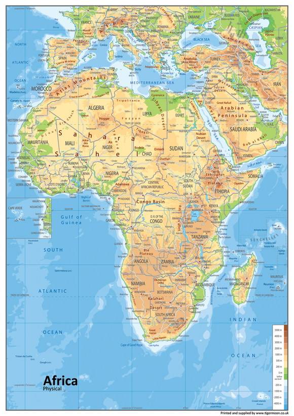
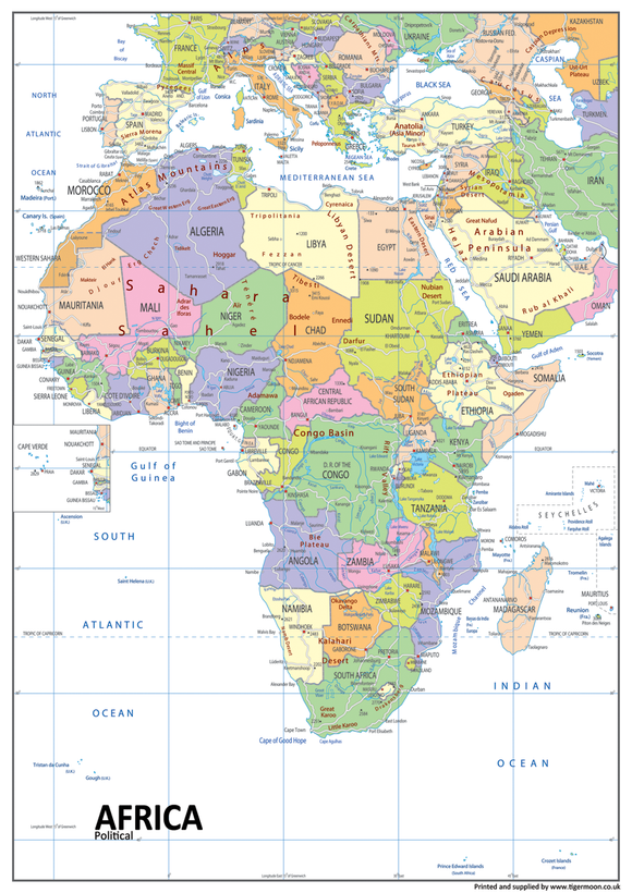
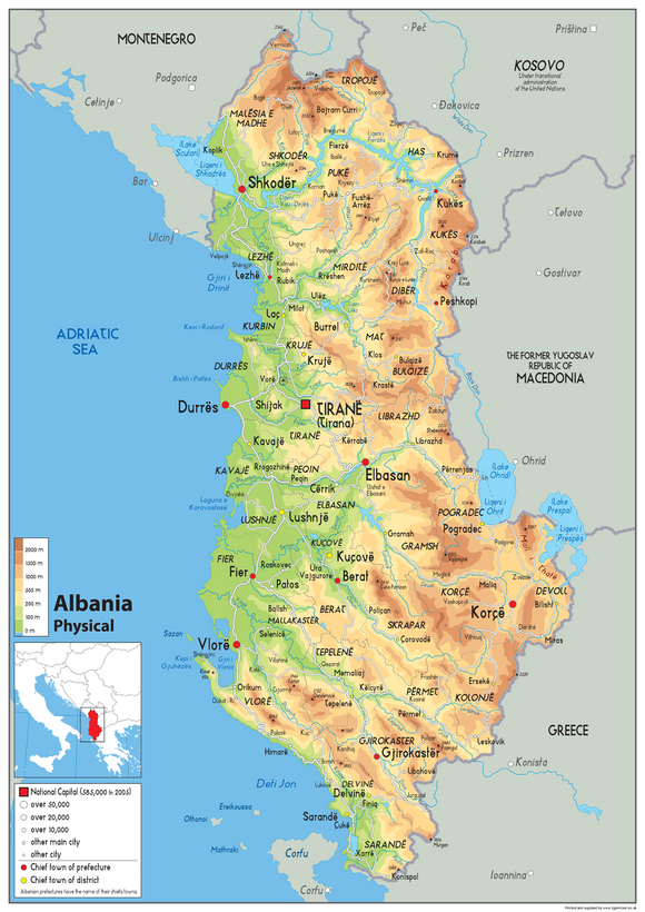
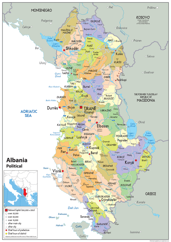
Physical Map of the Czech Republic - The Oxford Collection - Paper Laminated
Tax included.
Our Oxford Collection map of the Czech Republic boasts key attributes such as the capital city, population, area size, and main cities. In addition, this physical map shows state lines, highways, and airports, as well as oceans, lakes, and renowned attractions such as national and state parks, forests, and cultural sites. It is a perfect asset for classrooms and an exceptional resource for learning all that the country provides.
Printed onto a high quality paper and laminated for durability.
Available in sizes a2, a1 and a0