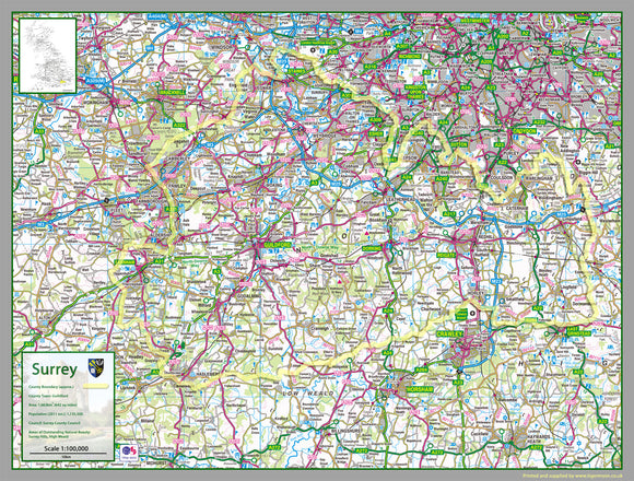


Surrey County Map
Tax included.
1:100,000 detailed map of Surrey, a county in England, UK.
This map covers the towns:
- Ashford
- Camberley
- Dorking
- Epsom
- Farnham
- Godalming
- Guildford
- Haslemere
- Horley
- Leatherhead
- Oxted
- Reigate
- Staines-upon-Thames
- Sunbury-on-Thames
- Weybridge
- Woking
and the districts:
- Spelthorne
- Runnymede
- Surrey Heath
- Woking
- Elmbridge
- Guildford
- Waverley
- Mole Valley
- Epsom and Ewell
- Reigate and Banstead
- Tandridge
The map features the county boundary, roads, railways, land features, water features and tourist information.