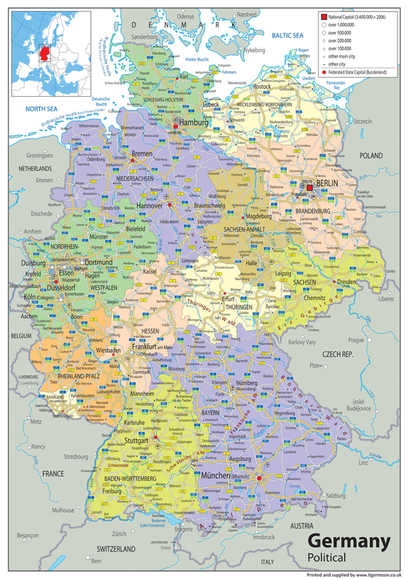


Germany Political Map – Political Features, Cities & Regional Geography | Multiple Materials
Explore the geography of Germany with this clear and colourful political map, showing the country's political features in an easy-to-read format. A useful resource for classrooms, schools and home learning, the map is ideal for geographical studies, teaching and revision.
Available in a choice of materials, it can be used as a wall display, educational reference or study resource.
Product Features
- Germany Political Map
- Political Features
- Political Geography
- Cities & Regional Geography
- Clear & Colourful Design
- Geography Classroom Resource
- Home Learning
- Study & Revision
- Educational Display
- Wall Display or Reference
- Multiple Material Options
- Paper Laminated
- Heavyweight Vinyl
- Mounted Board Option
Product Details
This colourful Germany Political Map provides a clear visual reference for studying the political geography of Germany. It is suitable for classroom and school displays, home learning, geography lessons, study and revision, and general geographical reference. The map is available in various sizes and material options to suit different display requirements.
Material & Finish
Paper Laminated: Printed onto high-quality paper and finished with a durable gloss laminate.
Vinyl: Printed onto hard-wearing, heavyweight vinyl banner material and supplied with metal eyelets in the corners for convenient hanging.
Mounted Board: Printed onto a rigid plastic board using stay-fast, waterproof inks. Supplied with holes and fixings for mounting.
Please note: Mounted maps require additional handling time of approximately 14 days.