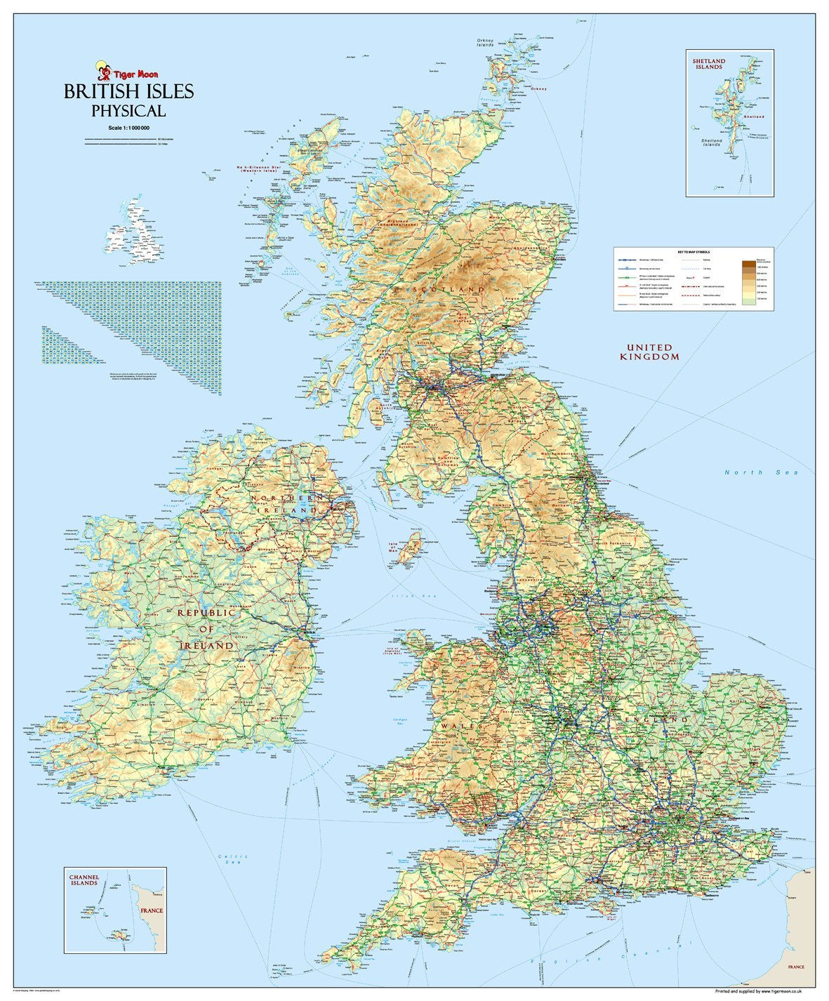

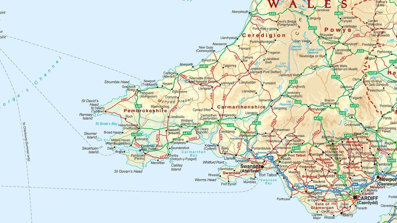
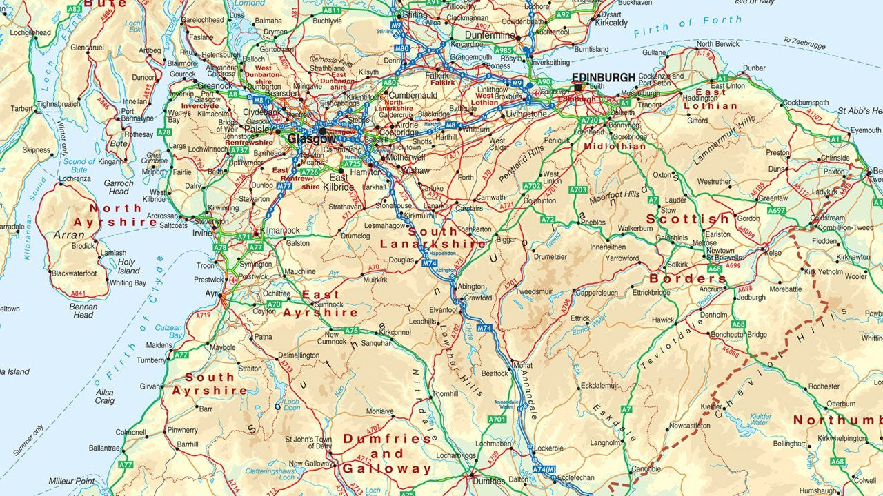

British Isles UK Physical Map
Tax included.
A large Physical map of the British Isles. Depicts relief and terrain detail through a unique blend of digital elevation modelling and realistic surface representation - some 80 million spot heights have been processed to create the hill shading. All major physical features are identified including mountains, rivers, islands, capes and bays. A bright, clear and attractive map.
Paper Laminated - Printed on high-quality poster paper which is then finished with a durable gloss laminate.